
Reviewed · HIKING & TREKKING
Santiago: Longueira, Pico de Antónia & Monte Tchota Trek
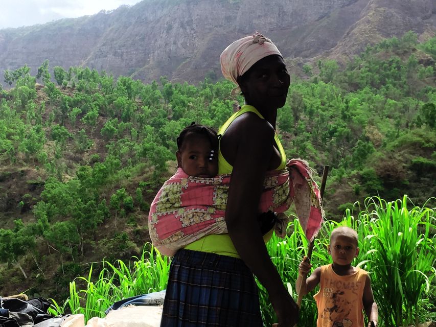
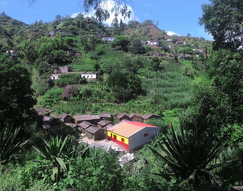
Santiago’s highest peak is the prize here, but the day begins with something just as valuable: a close look at village life in Longueira. You’ll visit a grogue distillery, a primary school, and Lemba Lemba Bar before trading farm paths for a steep mountain trail toward Pico de Antónia.
I like the mix of local contact and open-country hiking. I also like that the guides, including Ricardo, Djibril, and Admilson Garcia, are praised for being friendly, attentive, and helpful with the tough sections. The catch is simple: this is a difficult to very difficult trek, not a casual walk with a few uphill stretches.
Key points at a glance
- Longueira before the climb: Visit a local grogue distillery, the primary school, and Lemba Lemba Bar.
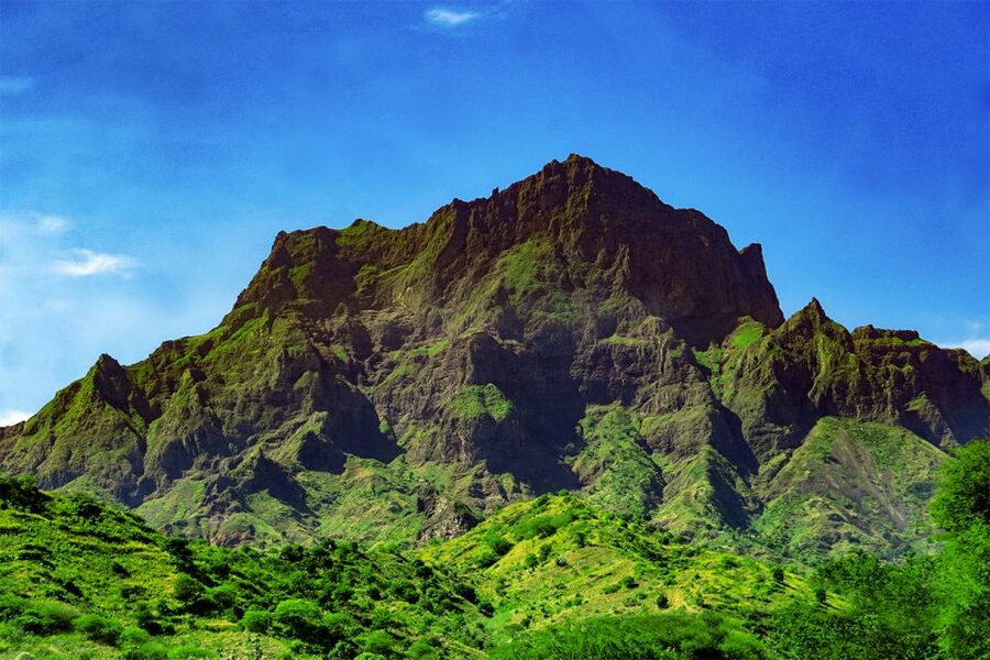
- Pico de Antónia: Reach a walking point around 1,394 meters, Santiago’s highest point.
- Long mountain day: The longer route covers about 9 kilometers and six hours of walking, with roughly 1,050 meters of ascent.
- Two route options: A shorter option covers about 6 kilometers and four hours, reaching around 1,160 meters.
- Big island views: On a clear day, you may see Maio Island and Fogo Island’s volcano.
- Useful support: Hotel pickup, transport, a guide, picnic, insurance, and walking sticks may be provided.
Longueira brings the mountain day down to earth
Pickup begins at your hotel in Praia. From there, transportation takes you toward Longueira, where the tour starts with a slice of everyday Santiago rather than a quick transfer straight to a trailhead.
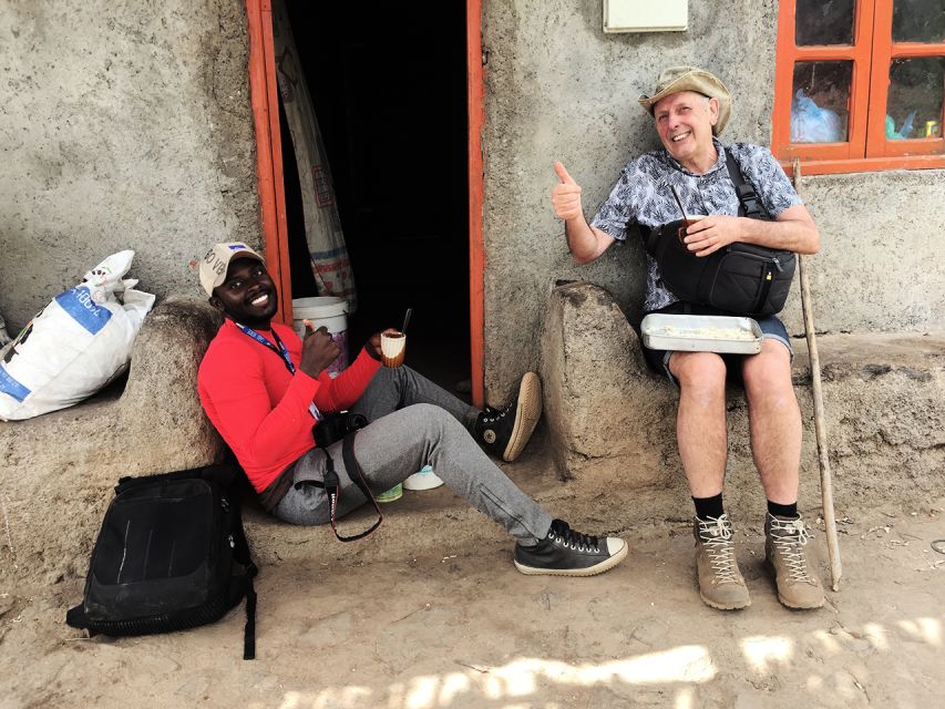
The village visits are not filler. At the grogue distillery, you get a look at the local rum-making tradition and the work behind Cape Verde’s cane spirit. You also visit the primary school and Lemba Lemba Bar, two stops that give the village a more human scale.
The value here is direct contact. You are not just looking at scenery from a vehicle window. You are meeting people in a place where daily life, farming, small businesses, and mountain routes all connect.
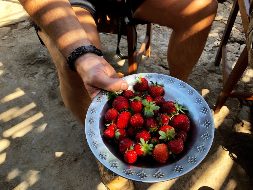
From December through May, the walk may pass among strawberry fields, followed by a small picnic. That seasonal detail matters. The farm sections can change the feel of the morning, so do not expect precisely the same view every month.
More Hiking Tours in Santiago
- Serra Malagueta: Principal Valley Hike & Lunch with Locals
★ 4.7 · 64 reviews - Praia: Baobab Mysterious Tree, Green Valley & Old City Hike
★ 4.8 · 53 reviews - Santiago: Calabaceira Valley Trek & Visit to Cidade Velha
★ 4.8 · 49 reviews
Two route choices, two very different days
The tour information gives two route options, and the difference is important.
The longer route is about 9 kilometers, with roughly six hours of walking. It climbs from around 485 meters to about 1,390 meters, gaining approximately 1,050 meters and losing about 600 meters. It is rated very difficult.
The shorter route covers about 6 kilometers and takes around four hours. It begins at roughly 485 meters, climbs to about 1,160 meters, and involves around 585 meters of ascent and 186 meters of descent. It is rated difficult.
Both routes are one way, with narrow and tilted paths. That means the challenge is not only the uphill distance. You also need to manage uneven footing, steep sections, and the descent. The longer route reaches higher, but the shorter option is still a real mountain walk.
The supplied description refers to about five hours uphill, while the route details give total walking times of four or six hours depending on the option. Plan around the route information rather than assuming this is a short morning hike.
Climbing Pico de Antónia, Santiago’s high point
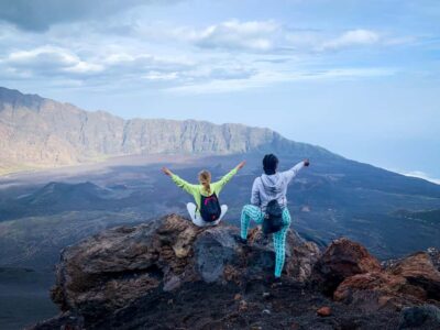
Pico de Antónia is the main event. At the walking point around 1,394 meters, you reach the highest part of Santiago Island by this route and earn wide views across the island.
The final section is where your preparation pays off. One account describes the last meters as especially steep, and another points out that the descent can take longer than the climb because it becomes very slippery. That is useful information, not a minor warning.
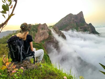
Take your time near the top. The view may include the São Jorge Valley, Maio Island, and the volcano on Fogo Island. Visibility will shape what you see, but the high viewpoint gives the tour its biggest visual reward.
This is also where a guide makes a real difference. Djibril is described as professional, cheerful, attentive, and respectful. Ricardo is praised for his kindness, while Admilson Garcia is known for pointing out photo spots and knowing the area and local residents. You may not have one of these guides on your date, but the tour uses local guides familiar with the route.
Why the plants and birds matter
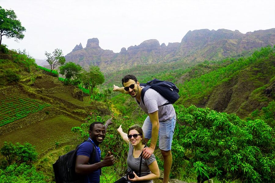
The trail is not only a climb to a number on a map. Along the way, you look for endemic plants and animals, as well as bird species considered at risk of extinction.
The information available does not promise a particular bird sighting, so keep expectations sensible. This is not a dedicated birding tour. Still, the chance to notice native plant life and birds adds meaning to the walk, especially as the route moves away from settled areas.
I would bring your curiosity as well as your camera. The guide can help you notice details you might otherwise pass by, while the changing elevation gives you different views of Santiago’s valleys and slopes.
More walks and treks on Praia:
- Santiago: Monte Tchota Natural Park to Pico d’Antónia Hike
★ 4.8 · 43 reviews - Serra Malagueta Natural Park Hike & Relaxing Swim at Tarrafal Beach
★ 5.0 · 30 reviews - Serra Malagueta Natural Park: Hike to Gongon Valley & Lunch
★ 4.8 · 22 reviews - Santiago Island: 4-Hour Calabaceira Valley Hike & Guided Tour to Cidade Velha
★ 5.0 · 18 reviews
Monte Tchota gives the finish a wilder feel
The trek finishes in Monte Tchota, also called Monte Txota, a natural park described as having intact nature and a range of plant and animal life.
That ending works well. After the village visit and the long climb, you reach a quieter setting where the focus returns to open ground, native species, and mountain air. It also means the day does not simply end at the summit and retrace the same experience.
The route is one way, so you should understand the finish before you set out. Your transport returns you to Praia after the walk, but the day includes a full transfer, a long hike, and a mountain descent. This is a full-day outing in practical terms, even though the exact timing is not specified.
The picnic is modest but useful
The included picnic consists of a soft drink, sandwich, and fruit. It is a practical break rather than a large meal.
That matters on a route with substantial elevation gain. You will want food and water available, especially on the longer option. The picnic gives you a planned pause, but bring extra water and do not treat the included snack as your only possible source of fuel for a six-hour mountain day.
From December to May, the picnic may take place near strawberry fields. That adds a pleasant seasonal touch, though the main reason to carry food and water remains the physical demand of the climb.
Come prepared for a steep and slippery trail
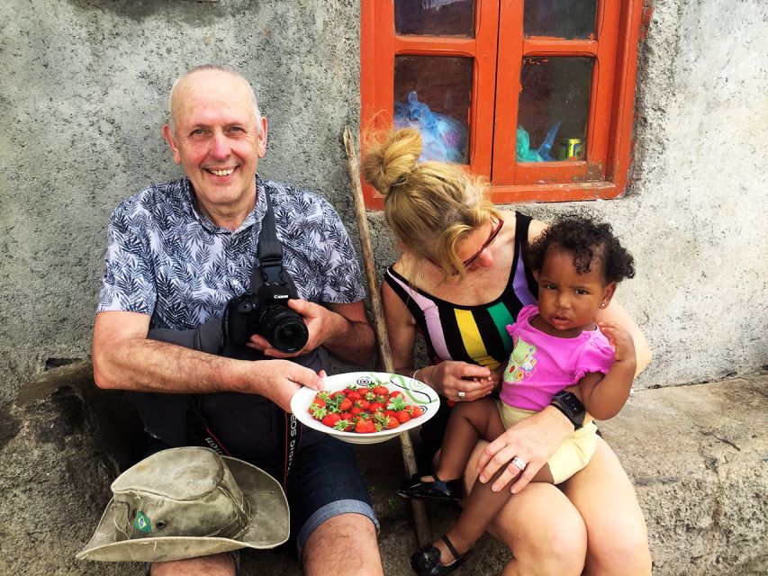
The operator calls hiking shoes a must, and I agree. The paths are narrow and tilted, and the descent can be very slippery. Trainers with smooth soles are a poor choice.
Pack:
- Hiking shoes with good grip
- A hat
- Sunscreen
- Plenty of water
- Hiking pants
- Walking sticks if you have them
Hiking pants are especially recommended from August through November. The tour team may provide walking sticks, and one account specifically found them very helpful. Still, I would confirm availability rather than assume every departure includes them.
The route information labels the longer version very difficult and the shorter version difficult. That should guide your decision more than the attractive photos. If you are not comfortable with sustained uphill walking, steep final sections, or slippery downhill paths, this is not the right excursion.
What the $106 price covers
At $106 per person, the price is reasonable if you want a guided mountain day with transport from Praia. The fee includes pickup and drop-off at your accommodation, transportation, a guide, the picnic, and liability insurance.
The value is strongest for someone who would otherwise need to arrange a vehicle, find the trail, organize a local guide, and work out the return from a one-way route. The local knowledge is also important because the path is narrow and the terrain can be tricky.
It is less compelling if you only want a viewpoint with minimal walking. You are paying for a demanding trek, not simply a drive to a scenic stop. The price also depends on the shared group operating with at least two participants.
If the minimum number is not reached, the provider may offer another date, charge an extra fee for a private departure, or cancel with a full refund. That condition is worth understanding before you build a tightly timed schedule around the outing.
Guides are part of the experience
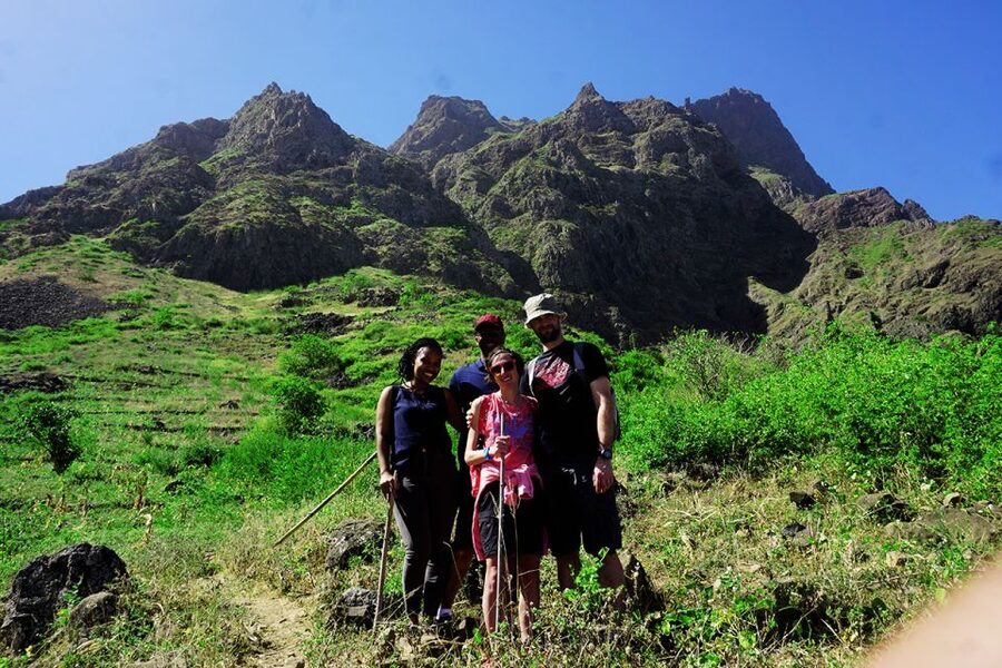
The guide can shape the day, especially on a route where pacing and footing matter. The named guides associated with this outing include Ricardo, Djibril, and Admilson Garcia.
Their praised qualities are practical: kindness, attentiveness, local familiarity, and help on slippery or steep sections. Admilson is also described as knowing the area well and showing good places for photographs.
The tour is offered in Spanish, English, French, and Portuguese. That gives you a better chance of matching your preferred language, though you should select or confirm the language when booking.
A good guide cannot remove the climb. What the guide can do is help you find the line through difficult sections, offer advice on the descent, point out local plants and animals, and keep the day organized.
Who should book this trek
I would recommend it to experienced hikers who want to see more of Santiago than Praia and who enjoy a full day outdoors. It suits you if the thought of a steep summit route sounds rewarding rather than intimidating.
It is also a good choice if you want local contact built into your nature day. The visit to Longueira gives the tour more character than a simple peak walk, while the distillery and village stops help connect the mountain to ordinary life on Santiago.
I would be cautious about booking it if you dislike narrow paths, loose or slippery ground, or long climbs. The final ascent can be steep, and the descent may be harder than expected. Families with young children, casual walkers, and anyone with limited mountain experience should think carefully before choosing the longer route.
Booking advice for your day in Santiago
Wear your hiking shoes from the moment pickup begins. Bring water, sunscreen, a hat, and a light snack even though a picnic is included.
Ask which route you are taking. The difference between about four hours and about six hours of walking, and between roughly 585 meters and 1,050 meters of ascent, is substantial.
Leave room in your schedule for transport, the village visits, the picnic, the climb, the descent, and the return to Praia. The cancellation policy allows a full refund when you cancel at least 24 hours ahead, which helps if your plans are still shifting.
Should you book Longueira, Pico de Antónia, and Monte Tchota?
Book this trek if you want Santiago’s toughest and most rewarding mountain day, with village contact before the climb and a natural park at the finish. The views toward the São Jorge Valley, Maio, and possibly Fogo give you a strong payoff for the effort.
Skip it if you want an easy excursion or a quick scenic outing. The trail is narrow, tilted, and sometimes slippery, and the longer version demands serious stamina. For fit hikers who prepare properly, the combination of Longueira, Pico de Antónia, and Monte Tchota offers a memorable way to see Santiago on foot.
FAQ
How much does the trek cost?
The price is $106 per person.
What is included in the price?
The tour includes hotel pickup and drop-off in Praia, transportation, a guide, a picnic with a soft drink, sandwich, and fruit, and liability insurance.
How long is the trek?
Two route options are provided. The longer route covers about 9 kilometers and takes around six hours of walking. The shorter route covers about 6 kilometers and takes around four hours.
How difficult is the hike?
The longer route is rated very difficult. The shorter route is rated difficult. Both use narrow, tilted paths, and hiking shoes are required.
How high does the route climb?
The longer route reaches about 1,390 meters, with an elevation gain of roughly 1,050 meters. The shorter route reaches about 1,160 meters, with an elevation gain of about 585 meters.
What should I bring?
Bring a hat, hiking shoes, sunscreen, and water. Hiking pants are especially advised from August through November, and walking sticks are highly recommended.
What languages are available?
The tour is offered in Spanish, English, French, and Portuguese.
What happens if the shared group does not reach two participants?
The provider may suggest another date, charge an additional fee to operate the tour privately, or cancel the booking with a full refund.
Newly listed around Praia
- Santiago Island: Private Airport Transfer to Praia or Vice Versa★ 5.0 · 3 reviews
- Hiking Águas Belas Cave★ 4.5 · 3 reviews
- Santiago Island: 4-Hour Calabaceira Valley Hike & Guided Tour to Cidade Velha★ 5.0 · 18 reviews
- Private Tour of Santiago – Discover the Island★ 4.5 · 18 reviews
- Tarrafal Beach Tour: Boat Trip to the Lighthouse, Snorkel & BBQ Lunch★ 5.0 · 5 reviews
- Best of Santiago Island: Cidade Velha, Workshop & Tarrafal Beach Tour★ 4.5 · 3 reviews
- Private Tour in Praia, Cape Verde★ 4.5 · 7 reviews
- Santiago Island: Banana Plantation, Natural Park & Workshop with a local family★ 5.0 · 10 reviews
Hiking & Trekking, compared.
Serra Malagueta: Principal Valley Hike & Lunch with Locals
Read our review →
Santiago Island: Serra Malagueta & Tarrafal Beach Trek Tour
Read our review →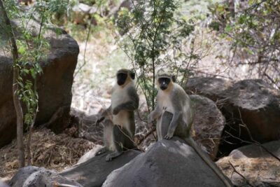
Baobab Mysterious Tree, Green Valley & Old City Hike
Read our review →
Monte Tchota Natural Park to Pico d’Antónia Hike
Read our review →
Browse the lists this tour appears in